

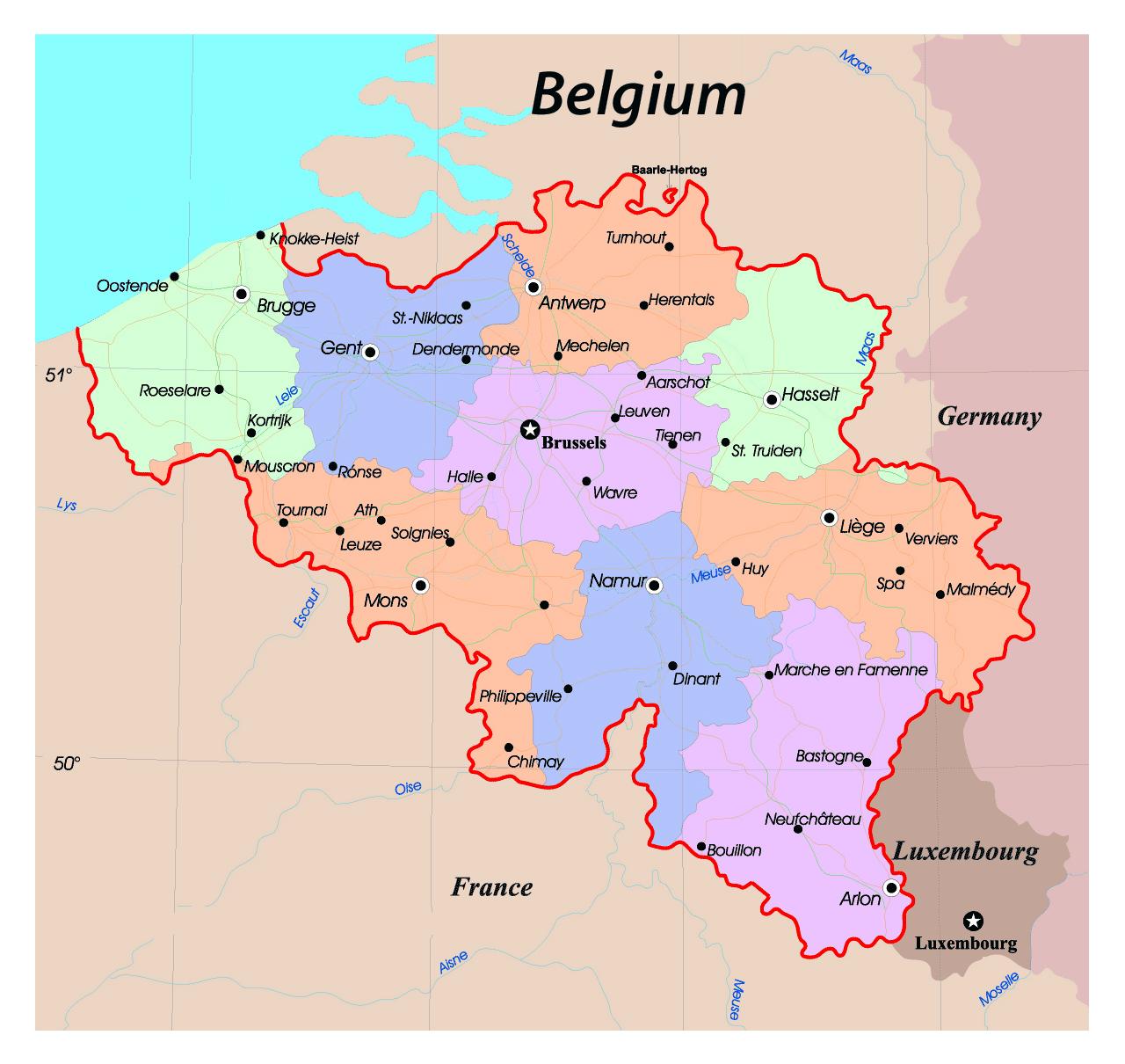
You can find on this page the Belgium region map to print and to download in PDF. The Belgium political map presents states, regions, provinces and surrounding areas of Belgium in Western Europe.

The Belgium regions map shows surrounding areas and provinces of Belgium. This administrative map of Belgium will allow you to know regions of Belgium in Western Europe. The Belgium regions map is downloadable in PDF, printable and free.
Belgium regions have authority in fields connected with their territory in the widest meaning of the term, thus relating to the economy, employment, agriculture, water policy, housing, public works, energy, transport, the environment, town and country planning, nature conservation, credit, and foreign trade as you can see in Belgium regions map. They supervise the provinces, municipalities and intercommunal utility companies. The Brussels-Capital Region cannot vote on competencies of the Flemish Region; thus in the Dutch language area a single institutional body of parliament and government is empowered for all except federal and specific municipal matters. While the Walloon Region and the French Community have separate parliaments and governments, the Parliament of the French Community draws its members from the French-speaking members of the Walloon Parliament and the Parliament of the Brussels-Capital Region.
The Flemish Region or Flanders (Vlaams Gewest or Vlaanderen in Dutch) occupies the northern part of Belgium. It has a surface area of 13,522 km2 (44.29% of Belgium) and is divided into 5 provinces which contain a total of 308 municipalities as its shown in Belgium regions map. The official language is Dutch. French can be used for certain administrative purposes in a dozen particular "municipalities with language facilities" around the Brussels-Capital Region and at the border with the Walloon Region. The Brussels-Capital Region (Brussels Hoofdstedelijk Gewest in Dutch, Région de Bruxelles-Capitale in French, Die Region Brüssel-Hauptstadt in German) or Brussels Region is centrally located and completely surrounded by the province of Flemish Brabant and thus by the Flemish Region. With a surface area of 162 km2 (0.53% of Belgium) it is the smallest of the three regions. It contains Brussels, which acts both as federal and regional capital, and in total 19 municipalities. The Brussels Capital Region contains only one administrative district, the Brussels Capital District.
The Walloon Region or Wallonia (Région Wallonne or Wallonie in French) occupies the southern part of Belgium. It has a surface area of 16,844 km2 (55.18% of Belgium) and is also divided into 5 provinces which contain a total of 262 municipalities as its mentioned in Belgium regions map. Its capital is Namur. The official languages are French and, only in the nine eastern municipalities that form the German-speaking Community near the German border, which were ceded by Germany after WWI, German. Dutch however, may be used for administrative purposes in the four municipalities with language facilities at the border with Flanders, and German in two such municipalities near the German-speaking Community.
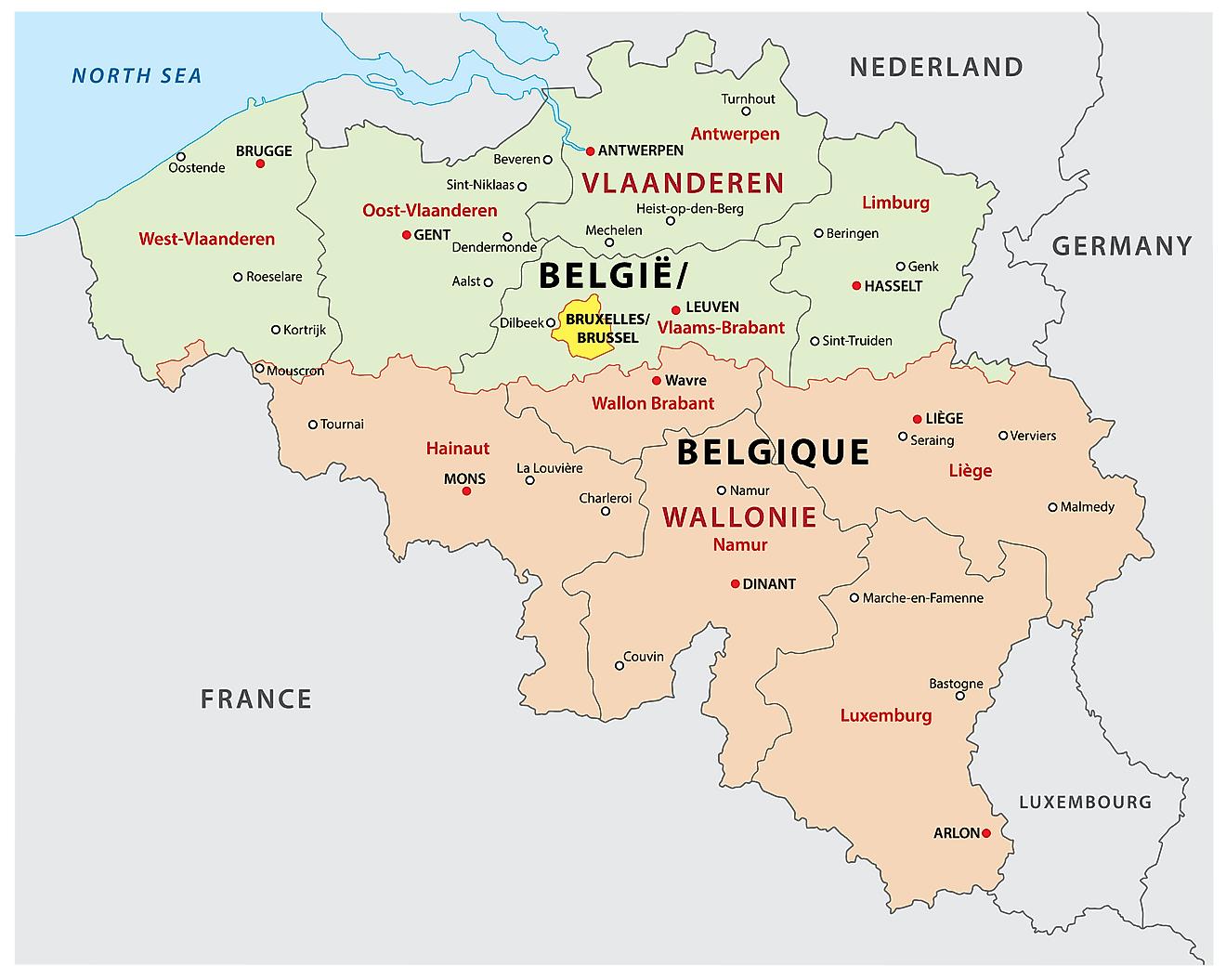
The Belgium political map shows regions and provinces of Belgium. This administrative map of Belgium will allow you to show regions, administrative borders and cities of Belgium in Western Europe. The Belgium political map is downloadable in PDF, printable and free.
Politics of Belgium takes place in a framework of a federal, parliamentary, representative democratic, constitutional monarchy, whereby the King of the Belgians is the Head of State and the Prime Minister of Belgium is the head of government in a multi-party system as you can see in Belgium political map. Executive power is exercised by the government. Federal legislative power is vested in both the government and the two chambers of parliament, the Senate and the Chamber of Representatives. The federation is made up of (cultural/political) communities and (territorial) regions. Belgium political institutions are complex. With an unbelievable number of political entities and institutions piled up on a small territory of 30,500 square kilometers, Belgium detains the European record of the most costly political system: no less than 57 ministers and state secretaries spread across six different governments, which are surrounded by seven parliaments and a dozen provincial governments.
Belgium political organization is seen as being the main cause of the communautarian permanent disputes in the country, and also as a major cause of the accelerating country debt issue. Most political power is organised around the need to represent the main cultural (and political) communities as its shown in Belgium political map. Since around 1970, the significant national Belgian political parties have split into distinct representations for each communities interests besides defenders of their ideologies. These parties belong to three main political families, though close to the centre: the right-wing Liberals, the social conservative Christian Democrats, and Socialists forming the left-wing. Other important newer parties are the Green parties and, nowadays mainly in Flanders, the nationalist and far-right parties. Politics is influenced by lobby groups, such as trade unions and employers organizations such as the Federation of Belgian Enterprises.
The Constitution of Belgium, the primary source of law and the basis of the political system of the Country, was established on February 7, 1831. It has been changed several times, but the most relevant reforms were performed in 1970 and in 1993 as its mentioned in Belgium political map. As titular head of state, the King plays a ceremonial and symbolic role in the nation. His main political function is to designate a political leader to form a new cabinet after an election or the resignation of a cabinet. In conditions where there is a "constructive vote of no-confidence," the government has to resign and the lower house of Parliament proposes a new Prime Minister to the King. The King is also seen as playing a symbolic unifying role, representing a common national Belgian identity. Members of the Federal Government, who are formally appointed by the King, are in fact drawn from the political parties which form the government coalition.
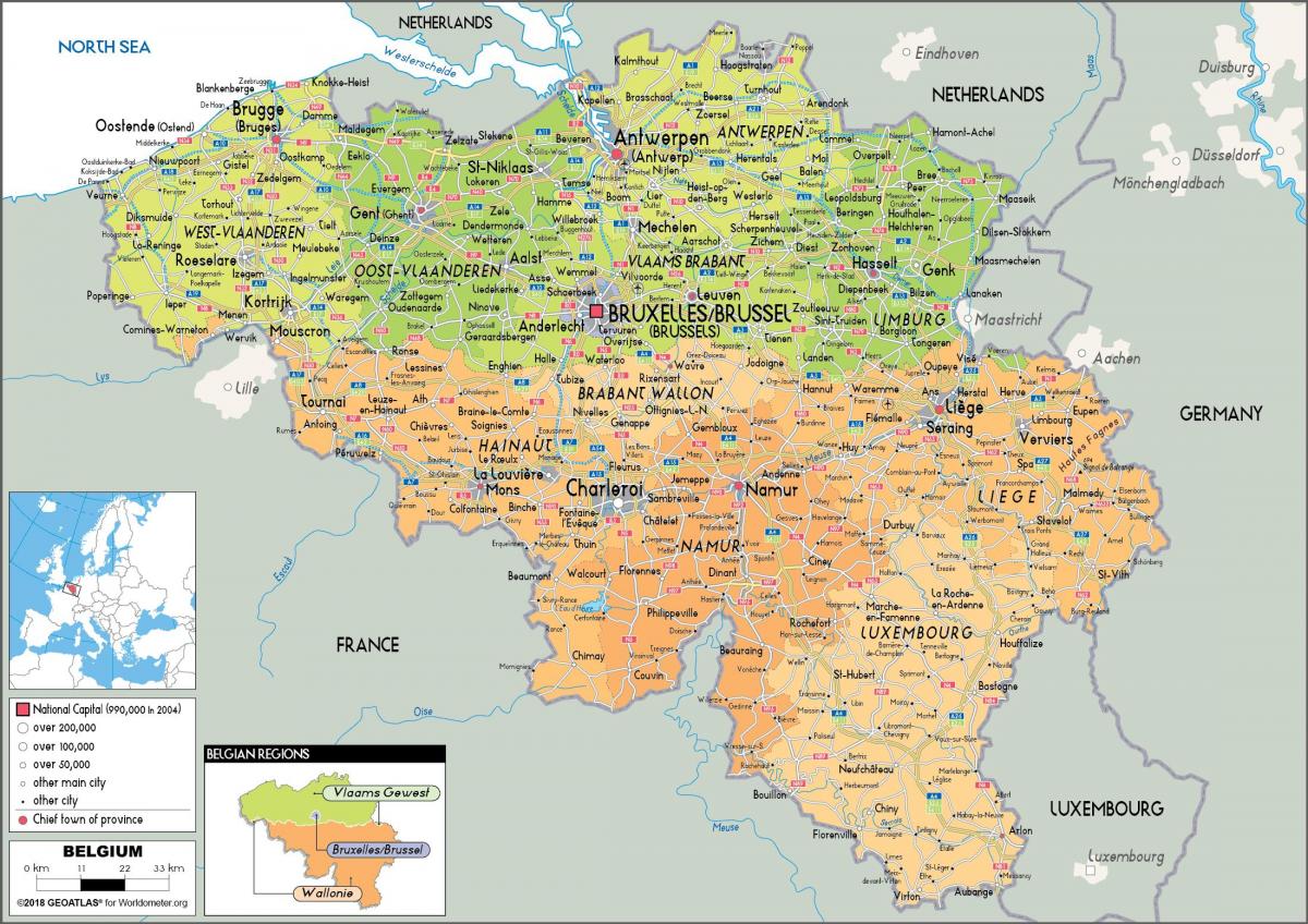
The Belgium states map shows all departments and regions of Belgium. States map of Belgium will allow you to know areas and cities of Belgium in Belgium. The Belgium states map is downloadable in PDF, printable and free.
Belgium is divided into three regions, two of them are subdivided into five states each as you can see in Belgium states map. The division into states is fixed by Article 5 of the Belgian Constitution. The states are further subdivided into arrondissements. The provincial government consists of three main parts: the Governor, an executive council known as the Permanent Deputation (Dutch: Bestendige Deputatie) in the Flemish Region, or as the Provincial College (French: Collège Provincial) in the Walloon Region, and the Provincial Council (Dutch: Provincieraad, the equivalent of a States-Provincial in the Netherlands), which is elected by the inhabitants of the province for a term of office of 6 years. The Permanent Deputations and the Provincial Colleges consist of seven members: the Governor and 6 Deputies elected by the Provincial Council from among its members. The numbers of seats in the Provincial Councils are proportional to the population of the province.
The Brussels-Capital Region does not belong to any state, nor does it contain any. The extraprovincial status of Brussels has existed since 1995, when the former province of Brabant, which had Brussels as its capital, was divided into the Dutch-speaking state of Flemish Brabant and the French-speaking state of Walloon Brabant as its shown in Belgium states map. Within this region, nearly all former provincial competencies are assumed by its regional institutions and by the French Community Commission, the Flemish Community Commission or the Common Community Commission. However, the Arrondissement of Brussels-Capital has two commissioners of the Federal Government who are called 'Governor of the Brussels-Capital Region' and 'Vice-Governor'. The Governor exercises most of the few remaining powers elsewhere exercised by a provincial governor, particularly in the field of public order, as far as no (federal) law, (regional) decree, ordinance or decision states otherwise.
The federal state of Belgium is divided into 10 states. The territory of Brussels-Capital is considered to be "free from states", i.e. provincial powers have been transferred to other bodies (Parliament of the Brussels-Capital Region, Community Commissions, etc.). The German-speaking Community is part of the Province of Liège. Since the creation of communities and regions, the provinces have lost their importance as administrative structures. They can take initiatives in all matters that are of interest to the provinces and do not fall under the competence of other authorities.These are the states in Wallonia: Liège, Namur, Luxembourg, Hainaut and Walloon Brabant. These are the states in Flanders as its mentioned in Belgium states map: Flemish Brabant, West Flanders, East Flanders, Antwerp and Limburg.